The problem with Vietnam is that while the satellite images are ok, the definition of the street maps are very poor. To position our travel points we have had to us GPS coordinates to position the locations on the satellite image. Here is how we are doing it.
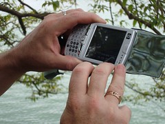
When we comes to a locations we would like to have registered on our google map I use a HP PDA which has a GPS receiver to capture the latitude and longitude. We then take a picture or video for use on the Google map with our regular digital cameras.
The PDA records the GPS in degrees, minutes, seconds eg. Latitude 21 deg 02 min 09 sec Longitude 105 deg 51 min 09 sec. For Google maps the format used is in decimal format so we use an online converter. There are numerous converters online however we have settled on this one from the FCC in America.
For example the the above points convert to Latitude 21.035833 Longitude 105.851667
One we have decimal valules these can be entered into the Google map search using the following format 21.035833, 105.851667
The result can be saved to our travel map, edited to have a title, description and image or video included.
While the PDA works well it does not have the best reception and is a tad slow to respond. So I am keeping my eye out for a cheap gps tool.
The final result
View Larger Map

1 comment:
That tag label was so apt !
Looks like you guys are having a great time. I spent today upgrading my blog to WP and building geeky things between naps.
Maybe it's the Capadex that's inspiring me.
More over at - http://alexanderhayes.com/2008/04/13/wp-25-wrapt/
Post a Comment